
Technical tours
To complement the official Congress program, there are several sites in Sydney, NSW and Canberra to consider engaging for technical tours.
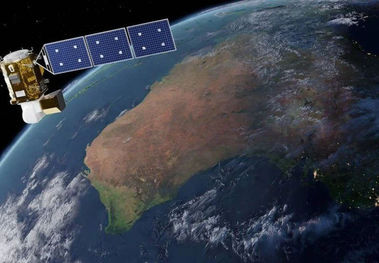
CSIRO Data61: Spatial Analytics, Artificial Intelligence and Earth Observation
This technical tour would highlight the work of CSIRO Data61, Australia’s national data science and digital research arm, which is based in Sydney.
The visit would focus on applied research in spatial analytics, Earth observation integration, and decision support systems. Delegates would gain insight into how satellite imagery, spatial modelling, and advanced analytics are combined to address complex national challenges. The tour would demonstrate the translation of photogrammetric and remote sensing research into operational tools, aligning strongly with ISPRS scientific priorities
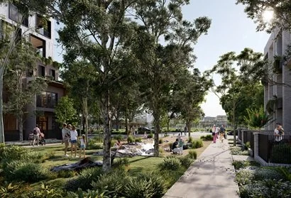
Sydney Science Park Urban Living Lab
This tour would present CSIRO’s Sydney Science Park Urban Living Lab, a precinct scale research environment focused on sustainability, water, energy, and urban systems. Delegates would learn how Earth observation, spatial data, and environmental modelling are applied to urban greening, climate resilience, and precinct planning.
The tour would illustrate how research outcomes are tested and implemented in a real world urban context, providing a strong example of applied urban remote sensing.
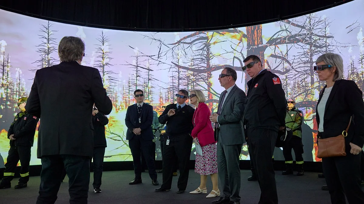
Bushfire Simulation and Visualisation
This tour would showcase UNSW’s iFIRE initiative, which develops advanced bushfire modelling, simulation, and visualisation systems. Delegates would be introduced to how satellite data, terrain models, and spatial analysis underpin fire behaviour research and risk assessment. The visit would emphasise the role of photogrammetry and remote sensing in disaster preparedness and environmental monitoring, areas of growing importance within ISPRS.

Emergency Services Spatial Technologies: Fire & Rescue NSW Academy
A visit to the Fire & Rescue NSW Emergency Services Academy at Orchard Hills would demonstrate how spatial technologies are integrated into emergency response training. The Academy hosts drone operations, immersive simulation environments, and spatially enabled training facilities. This tour would provide delegates with insight into the operational use of UAVs, mapping, and geospatial technologies in emergency management.
-
Operational Geospatial Intelligence: NSW Rural Fire Service Headquarters
This tour would focus on the NSW Rural Fire Service Headquarters, highlighting the operational use of GIS, satellite imagery, and spatial intelligence in managing large scale bushfire and flood events. Delegates would gain an understanding of how near real time Earth observation data supports decision making under emergency conditions.
-
Water Monitoring and Compliance Using Earth Observation: WaterNSW
This tour would present WaterNSW’s application of satellite imagery, UAVs, and artificial intelligence to monitor water resources across New South Wales. Topics would include dam and reservoir monitoring, floodplain analysis, and water quality assessment. The tour would demonstrate how photogrammetry and remote sensing are used in regulatory compliance and sustainable water management.
-
Transport Spatial Research and Analytics
This tour would present the work of the Transport for NSW Research Hub, focusing on the use of spatial data and analytics to support transport planning and policy evaluation. The visit highlights how geospatial information contributes to infrastructure management and urban mobility research in a global city.
-
Landscape Scale LiDAR and Ecological Restoration: Mulligans Flat–Goorooyaroo Woodland Sanctuary
This tour combines LiDAR based research with ecological restoration outcomes at Mulligans Flat– Goorooyaroo Woodland Sanctuary. Delegates can explore how remote sensing supports biodiversity monitoring and habitat analysis. There are facilities for technical presentations, enabling integration of field observations with scientific discussion.
-
Statewide Spatial Infrastructure and Digital Twins: NSW Spatial Services
This tour would highlight NSW Spatial Services and their role in maintaining authoritative spatial datasets and the NSW Spatial Digital Twin. Delegates would learn about statewide LiDAR acquisition, elevation modelling, and data governance frameworks that underpin planning, infrastructure delivery, and emergency response. This could be a regional tour to Bathurst or they could organise an event right here in Sydney.
-
National Earth Observation Programs: Geoscience Australia (Canberra)
This tour would introduce delegates to Geoscience Australia’s Earth Observation programs, which support national mapping, hazard monitoring, and environmental assessment. The visit would provide an overview of Australia’s federal EO capabilities and their relevance to global ISPRS initiatives. This tour would be a great day trip from Sydney stopping off at local landmarks along with way.